HIGH WILLHAYS, Dartmoor
22 September 2021
Otherwise known as High Willes. 2,039 feet (621 metres).
Weather: perfect walking weather, sun with scudding high clouds, around 17°C.
Duration of walk. About 4.5 hours.
Artistic endeavour: a Clerihew appropriate to the area.
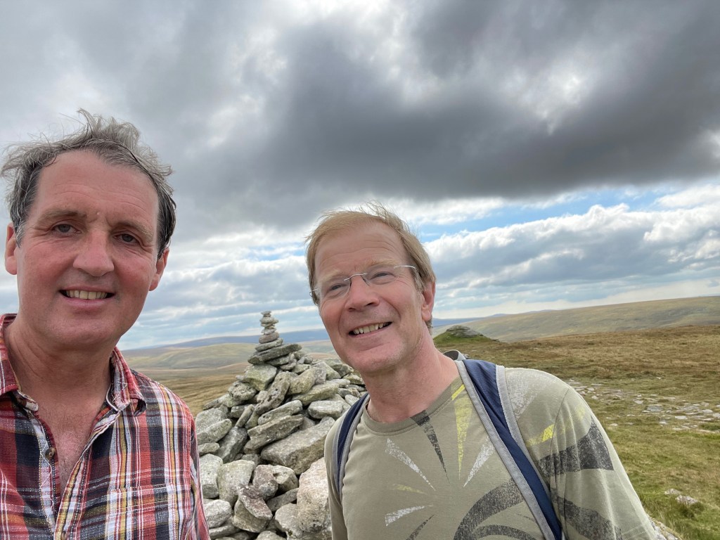
Iain and Antony on the summit of High Willhays
This is the second county top in the project, and I arranged to climb it with my friend Antony, a keen walker. A week earlier I had injured my right knee playing cricket, so this proved a more than usually testing climb. I was grateful for Antony’s encouragement and his willingness to act as sherpa in the important matter of carrying the sandwiches.
We parked at the Meldon Reservoir car park, run by the Dartmoor National Park authority. A popular starting point for walks, this features a toilet block and some information signs and maps. The walk begins by crossing the dam which blocks the end of the reservoir. The reservoir and dam were built in the early 1970s. Apparently it is a wild swimming opportunity, but we did not take advantage of this.
The walk commences at a height above sea level of around 900 feet, so is not quite as challenging as it might seem. It begins with a delightful stroll round the reservoir and then following a stream which is bounded by ancient rowans and oak trees, featuring a waterfall. A short distance after the waterfall, a faint path can be seen off to the left, leading up to the summit of Black Tor. This needs to be climbed to reach the path to High Willhays, but is a worthwhile hike in its own right. If anything the views from the top are even more spectacular, looking down the valley of the West Okement River. The climb up Black Tor is by far the most strenuous part of the walk, emerging from a boggy flat land to a steep and rocky slope.
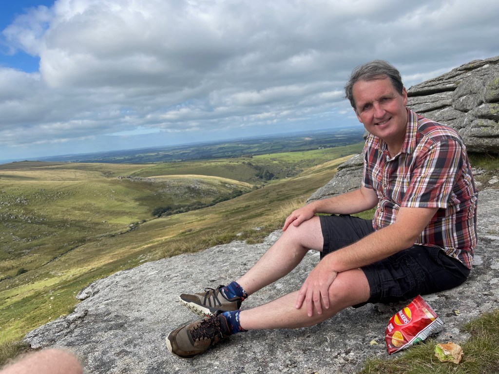
The top of Black Tor made an ideal lunch spot. We set off for the summit of High Willhays which could easily be seen in the distance. High Willhays lies in the middle of a ridge also featuring Yes Tor which was for many years itself thought to be the highest point of Dartmoor. It now seems to be generally agreed that High Willhays is 2 metres higher (surely increased further by the substantial cairn of stones which has been assembled on top), but we decided to climb both just to be sure. A steep clamber down from Yes Tor was the worst part of the climb for my right knee, but soon we returned to the reservoir after a 6 mile round trip.
We discovered half way through the walk that the area around High Willhays was in fact in a Ministry of Defence live firing zone. Fortunately the public are allowed access unless warned to the contrary by red flags, flown from posts with dramatic warnings (see below). No red flags were visible.
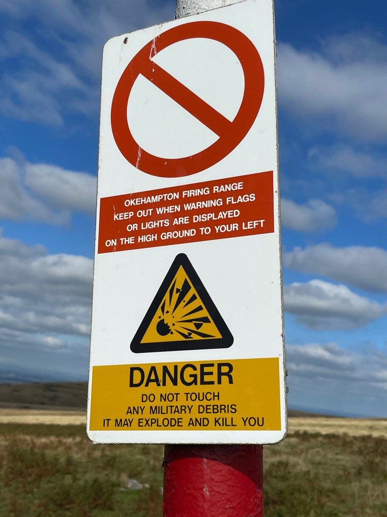
We had all this explained to us by an interesting lady whom we had asked for directions on the basis that she was sensibly attired and equipped with a proper Ordnance Survey map. She also informed us (somewhat redundantly) that we were not allowed to carry uncovered guns in the area. Questioned as to how she knew the gun regulations, she replied that she was in the habit of shooting deer in Scotland.
At various points in the walk, we came across platoons of troops apparently on training expeditions. All of them were carrying rifles. The final platoon was resting by the side of the path, and greeted us warily. They looked ready to retake the Falkland Islands or win any similar battle involving remote moorland whenever it became necessary to do so. I was reminded of Lord Wellington’s comment about his soldiers on the eve of Waterloo ‘I don’t know what effect these men will have on the enemy but by God they frighten me.’
The landscape of High Willhays might be expected to be similar to that of Brown Willy, the highest point of Cornwall, covered in the previous blog post. The geology of Bodmin Moor and Dartmoor are similar, and both peaks are situated towards the Northern tips of their respective moors. However, High Willhays and its surrounding moor are much barer and bleaker than their Bodmin equivalents, possibly because they are higher. There is little vegetation apart from grass, grazed by a few sheep and ponies. For those interested in statistics, High WIllhays is the highest point in Southern England, higher than anywhere south of Kinder Scout in Derbyshire (another county top to be climbed), which tops out at 636 metres, and the Black Mountain on the border of Herefordshire (703 metres).
This was a truly lovely walk on a perfect day. The views to the South took in infinite expanses of moorland, broken by occasional rocky outcrops. To the North stretched the vast Devon patchwork of green fields divided by hedges, Exmoor just visible far to the North East. The coastline and the towns of Bideford, Barstaple and Bude were too far away to see even on that clear day from such a high vantage point.
For the appropriate artistic endeavour of this journey, Antony and I attempted a recording of a Devon folk tune on the summit. Unfortunately I have now discovered the tune was not from Devon at all. So we will have to try again on one of the remaining summits with better research!
As a replacement, I have attempted to write a ‘Clerihew’ inspired by the most famous work of literature set on Dartmoor. A Clerihew is a humorous 4 line poem rhyming AA, BB, in which a famous person features in the first line (his or her name preferably taking up the whole line). It also uses lines of mismatched lengths.
The author of the Sherlock Holmes novels famously hated writing them. So he tried to to kill off his popular detective by throwing him and his nemesis, Moriarty, off the Reichenbach Falls in Austria in the novel ‘The Final Problem’. But the public outcry was such that he was forced to write another series, starting with the ‘Hound of the Baskervilles’.
Sir Arthur Conan Doyle
Thought Sherlock’s death would save him further toil.
But readers refused to believe the detective had drowned.
Hence the Baskerville hound.
